Land id
REQUEST A MEETING
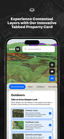
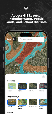
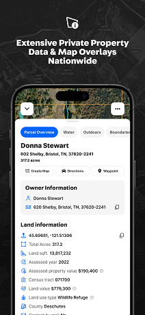
Land id is a web and mobile mapping platform offering easy-to-use GIS tools for assessing properties for flood and hazard risks. It provides extensive geospatial data and custom map-building features to help organizations coordinate disaster response, track assets, and improve team communication.
Booth Number: 944